

August 17, 2022
Camera strolls around Japan
The following two videos were upscaled and colorized from the original black and white film. The first dates to 1913–1915, and the camera is the obvious center of attention, few Japanese having ever seen one before.
Incidentally, this footage was shot during the Taisho era, the same time period as Demon Slayer.
The second is from the late 1940s. In a couple of frames toward the end, you can pick out speed limit signs written in English for the Occupation forces.
This documentary about everyday life in Tokyo was made by a German film crew in 1966.
To bring things up to the present, walking around Japan with an HD camera has become a popular YouTube hobby, though NHK has been doing it for years with its Somewhere Street series.
You can take your own custom tour around Japan practically wherever you want. Bring up Google Maps, zoom in on Japan, pick a city, and switch to Street View.
Related links
Rambalac
Tokyo NSK
Off to Japan
Labels: anime, geography, google maps, history, japan


September 26, 2013
Japan photo tours
If you're looking for a higher-resolution Japan travel experience than Google Street View (short of actually being there), your best option is an ambling photo blogger with a decent camera. Danny Choo has assembled a generous collection of mostly Tokyo-based photo tours here and here.
 |
| Places to visit in Japan |
 |
| Tokyo Photo Walk |
Labels: google maps, japan, photo tour
September 19, 2013
Virtual disaster tourism
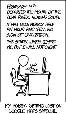
As xkcd points out, you can see the world these days without ever leaving home.

That now includes disaster tourism. Earlier this year, Google sent a Street View car through the town of Namie, next door to the Fukushima Daiichi nuclear power plant. The area's been evacuated because of radiation contamination.
It's Life After People, only for real.
That now includes disaster tourism. Earlier this year, Google sent a Street View car through the town of Namie, next door to the Fukushima Daiichi nuclear power plant. The area's been evacuated because of radiation contamination.
It's Life After People, only for real.
Labels: google maps, japan, photo tour
July 19, 2012
Mt. Kôya up close
In chapter 36 of Serpent of Time, Ryô sneaks back inside the Konpon Dai pagoda.
PC Magazine columnist John Dvorak recently sang the praises of Google Street View. The enthusiasm is well deserved. Since I started writing Serpent of Time, the Google Street View car has gotten around to covering all of the same routes that Ryô does.
And now that includes Mt. Kôya. There must be a Google Street View person--carrying something like a Steadicam--because you can walk around and inside the Konpon Dai-tô. Dvorak's right. This is one of the coolest things the Internet has pulled off.
View Larger Map
Labels: geography, google maps, serpent of time
March 14, 2011
Sendai earthquake (1)
The magnitude of 9.0 (revised) made it the biggest known earthquake to hit Japan in its recorded history.
The earthquake on Friday was preceded earlier in the week by dozens of five to seven magnitude deep-sea earthquakes in the same area, off the coast of Sendai. None of the tsunami forecasts at the time exceeded eighteen inches, and none of them reached even that height.
In this case, though, the boy cried wolf and the wolf came.
Read more »
Labels: earthquake, geology, google maps, japan, science, tohoku earthquake
March 10, 2011
Thank the new for the old
Maps like this one are ubiquitous in Japan. The site I copied it from specializes in making them (go here for more examples). Like the plastic food that adorns restaurant windows, necessity combined with Japanese ingenuity turned the map into a showcase for utilitarian yet eye-catching industrial design.

Though the main roads in and between Japan's cities have street names, the traditional addressing system is block-based, not street-based. Think of a city as a big block divided into smaller blocks. At the street level of granularity, the buildings are numbered sequentially around the block.
This is quite logical and works fine--in theory--until the block is (inevitably) physically altered, at which point the numbering system goes haywire. And since only out in the sticks in Japan do you find towns that haven't been profoundly altered in the past fifty years, the whole system is haywire from top to bottom.
Hence the proliferation of WYSIWYG feature-based maps. Why don't they "fix" it? I suppose for the same reason we Americans talk a lot about it but never get around to normalizing English spelling or adopting the metric system.
Anyway, who cares about the addressing system when you've got GPS and Google Maps (and ubiquitous police boxes staffed by beat cops)? One irony of modern technology is not that it eradicates the old, but that it preserves it so well.
Chinese orthography was radically simplified under Mao (and not for the first time). In Japan, some hesitant steps were taken in that direction, but first the fax machine and then the IME (input method engine) made it so easy to convert phonetic characters to kanji that it's become a non-issue.
In fact, characters that were once abandoned in favor of kana are appearing again in wide circulation. A semi-literate gaijin like me can type the kanji for "rose" (薔薇) as easily as any native-born and educated Japanese. Cutting-edge technology keeps these antiquated systems chugging along.
Related posts
Off the map
Hero
Labels: google maps, japan, language, social studies
March 03, 2011
Off the map
The problem with maps is that they don't tell you what's not on the map.
In Demon City Shinjuku, after escaping from Chuo Park (where they were going last time), Kyoya and Sayaka head to Kabukicho. I've never been there. So again, I turned to Google Maps to align Kikuchi's descriptions with the real thing. But then I ran into a thornier problem. He describes a "Center Street" (中央通り) that is only a block long. It wasn't on any of the maps. Or rather, there are "Center Streets" all over the place.
But none where this one was supposed to be. Finally, I turned to Google Images and after a bit of searching dug up this.

There it is, as Kikuchi described it. The "Center Street" block dead-ends at the Koma Theater. It must be a local designation that didn't make it onto the official maps.
Another interesting aspect of Kikuchi's Kabukicho is that here in the real world, the Koma Theater has closed. A problem with writing stories about the near future is that the near future has a tendency not to turn out the way you foresaw it.
This doesn't actually disturb the timeline of Demon City Shinjuku and the sequels. The "Devil Quake" that separates Shinjuku metaphysically from the rest of the world occurs in the first decade of the 21st century. Since then, the alternate history of Demon City Shinjuku would have split off on another vector.
And for now, the Koma Theater marquee is still there. Using Google Street View, you can virtually look up and read: "Thank you for 52 years of patronage."

Labels: demon city, google maps, japan, translations
February 28, 2011
A Google Maps moment
I was translating the following passage from Demon City Shinjuku:
"Ten Street" is an elevated road, as are the plazas of the buildings along it. The problem was, I couldn't picture the geometry of the lower road level, but was pretty sure it ran under Ten Street at right angles, and continued on to Chuo Park, Kyoya's destination.
To the cloud! Well, not the Microsoft one. Google Maps and Street View to the rescue!

The triangular building is the Sumitomo Building. You can see the flight of stairs there on the left. The dark red line is the subway running from Shinjuku Station on the right under Chuo Park on the left. So I added for the benefit of those not familiar with the geography:
I don't play video games, but I can waste a whole lot of time cruising around Japan using Street View.
Ten Street ran between the Sumitomo and Mitsui buildings before intersecting with the old Koshu Highway. A hundred feet further on and to [Kyoya's] left rose the majestic Keio Plaza Hotel. A dozen yards behind him was a flight of stairs leading down to the lower road level.
"Ten Street" is an elevated road, as are the plazas of the buildings along it. The problem was, I couldn't picture the geometry of the lower road level, but was pretty sure it ran under Ten Street at right angles, and continued on to Chuo Park, Kyoya's destination.
To the cloud! Well, not the Microsoft one. Google Maps and Street View to the rescue!

The triangular building is the Sumitomo Building. You can see the flight of stairs there on the left. The dark red line is the subway running from Shinjuku Station on the right under Chuo Park on the left. So I added for the benefit of those not familiar with the geography:
It crossed beneath Ten Street at right angles, linking the west entrance of Shinjuku Station to Chuo Park.
I don't play video games, but I can waste a whole lot of time cruising around Japan using Street View.
Labels: demon city, google maps, japan, photo tour, translations
August 27, 2009
You can go home again (virtually)
 Thanks to Google Maps, "googling yourself" takes on a whole new meaning, especially because most addresses in the U.S. have a "street view." It does feel a little creepy at first, but only because you recognize the view. After all, for most people, more relevant "personal" information is available in an online telephone book, not to mention a credit report.
Looking at the house I grew up in reveals that the cul-de-sac has pretty much remained the same a quarter-century later. More interesting is what happened to the lot behind the house where the Mormon church used to be. As I document in a fictionalized account here, it burned down over a decade ago. Because the drainage had always been marginal for a structure that large, it wasn't rebuilt.
Two McMansions sit on the lot now. The woods are still there (again, thick shale and a high water table and upstate New York's long-depressed housing market discourage development). I spent a good portion of my childhood playing in those swamp-infested woods (this was before the present era of permanent parental paranoia), but never before had a good sense of their size (about a half-mile deep and a half-mile wide) or their relationship to the surrounding neighborhoods.
Back then, those woods seemed to go on forever. Google Maps casts those memories in a whole new light.
Labels: autobiography, google maps, lds, photo tour, social studies
August 25, 2009
Literary vacations
Justine at the Segullah blog recalls an encounter with an enthusiastic Twilight fan and wonders which real-life book settings are actually worth visiting. Conclusion: Stratford-on-Avon: yes. Forks, Washington: no. And for that matter, Sandy, Utah: also a no.
Prince Edward Island is a major holiday destination for Japanese fans of Anne of Green Gables. As a general rule, I would say that there must be some historic--other than pop literary--or aesthetic value to the place. So, while Sandy doesn't qualify, plenty of other tourist traps in Utah do.
But if you want to test the waters first without going there, try Google Maps. Type in the address or the general location. The satellite resolution available for places like Stratford-Upon-Avon is amazing. And you can even walk around Temple Square using Street View.
I'm writing a sequel of sorts to Path of Dreams. Part of it takes place at Mt. Koya. Although I spent a touristy day there when I was living in Osaka, Google Maps is an extremely useful tool for reminding myself where everything is. The bird's eye view alone kindles surprising feelings of nostalgia.
Being on the subject of (Mormon) vampires, Justine also links to her (favorable) review of Angel Falling Softly.
Labels: angel falling softly, anne, books, google maps, japan, lds, path of dreams, photo tour, twilight
September 27, 2007
Manji
An architectural kerfuffle recently broke out thanks to Google Maps, when a Navy barracks turned out to resemble a swastika when viewed from above. The swastika is actually an ancient Sanskrit symbol associated with holiness. That is, until the Nazis stole it and ruined it in the public consciousness.
In Japan, the left-facing swastika or manji (卍) is used to indicate a Buddhist temple. In this Google map of Kamakura, every manji symbol is a temple. If the opportunity presents itself, put Kamakura on your list of places to see when you're in Japan. It's an easy day trip from downtown Tokyo.
In Japan, the left-facing swastika or manji (卍) is used to indicate a Buddhist temple. In this Google map of Kamakura, every manji symbol is a temple. If the opportunity presents itself, put Kamakura on your list of places to see when you're in Japan. It's an easy day trip from downtown Tokyo.
Labels: buddhism, google maps, japan